"Bunloc Fortification" - The Project
A. Tourism in Sacele - Bunloc area.
Location.
Access roads.
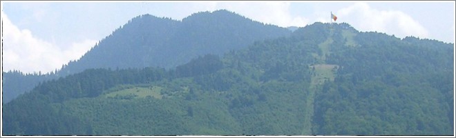
Sacele city is located in the south-east of Brasov County, in the vicinity of Brasov (15 km away from Brasov City Center). It's crossed by the road DN1A (Brasov - Valenii de Munte - Predeal) and DN1 (Bucharest - Brasov the major national road). Bunloc Hill is in near proximity of Sacele City, "guarding" the entrance in Sacele from Brasov driving on DN1A and DN1.
Natural environment.
Sacele City is the gateway of Ciucas Mountains and Piatra Mare Massif. There are many treckking routes arround (from easy to hard) and some preety interesting natural highlights: the Ice Cave, The Written Stone, The Bear Crag, the Canyon of The "Seven Ladders", Tamina Waterfall, the Summital Plateau of Piatra Mare Massif).
Thumbs up's for Tourism in the area:
- The Natural Scenery.
- Easy access from DN1 National Road.
- Easy Access up on the Bunloc-Hill - chairlift and marked trakkin' routes.
- Bunloc Chalet - located on the way to Piatra Mare Massif
- The opportunity to practice "adrenalline rush activities": Skiing, Hiking, Free-Climbing, Paragliding, Moutain Biking and Downhill.
- Recreation&Picnic Area of Poiana Angelescu-Sacele... a place for traditional food and local-style festivals.
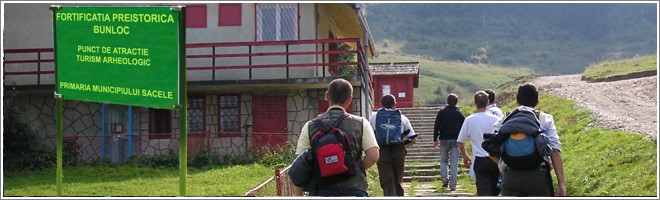
B. The Bunloc Fortification
Location:
Middle and upper part of the Bunloc Hill.
Altitude:
Between 850-1100 m
Area:
Estimated arround 100 ha
Must sees:
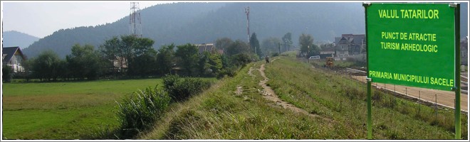
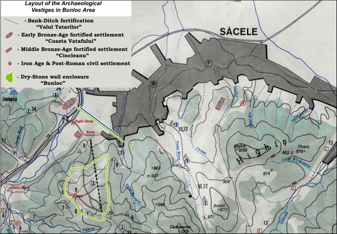
- Triangular shaped fortification streched over 100 hectares, defended by a dry stone wall (4 km long, from1 to 2 m wide, from 0.5 to 0.8 m in hight);
- Tatars Rampart (1.2 km long, 12m width, 8m high) - An forward defense fortification to block the acess from North into the area.
The Importance:
- The Existence of a Unique Defensive-Complex in Romania by size and design
- A Touristic Area... just great for Extreme Sports
- A Location near The first national road in Romania - DN1
- Easy Access uphill by chairlift
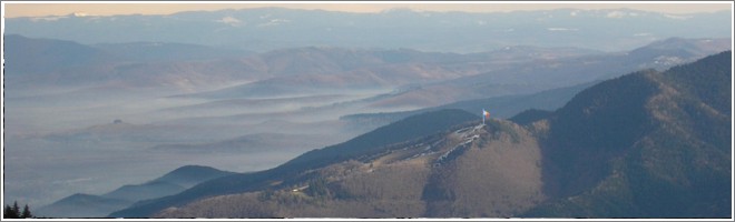
- Amazing Panorama over miles of Teutonic Lands (Burzenland).

Google Earth Visualization of The Bunloc Fortification
(Download .kmz)
You may need to download and install a free version of Google Earth (download here)
The Research on Bunloc Fortification:
- The 2005 Archaeological Campaign - S.C. "Damasus" S.R.L.
Conclusions:
"There is of a fortified settlement on The Bunloc Hill whose inhabitants used a rudimental pottery, badly burned and manually made..... We propose this Archaeological Site to be included on The National Archaeological Record of Romania.
The 2006 Campaign - National History Museum of Alba Iulia
Conclusions:
"We conclude by saying we face a unique situation and exceptionally interesting for both specialists and general public interested in history and we recommend further archaeological research. We have to mention the unique situation for Transylvanian archaeology too; a defensive complex that combines a stone-wall enclosure and a rampart - at such a scale wasn't so far discovered by anyone, anywhere in this part of our contry. So, we face a unique and extremely dramatic situation, where further systematic archaeological research in the area would have major role in the knowledge on defensive systems used in Transylvania in the Early Middle Ages. "
The 2007 Archaeological Campaign - National History Museum of Alba Iulia
Conclusions:
New information brought excavations carried on the stone enclosure on the north side. On this occasion we observed a clear dry stone wall, with its structure. The building technique its an additional plea, if there were any doubts, as a complex defensive work. The wall seems to have been doubled in some areas, with a small vallum supporting on the inside. Unfortunately, during our research we haven't discovered any artefact suited for dating this impressive fortifications. For this reason, we are again in position to wait for further research to bring about the much anticipated answer of specifying the period that belonged Bunloc Hill Fortification, causes for its rise.
Beyond providing a possible answer to the major question raised by fortification dating, the future research needs to address the defensive system, especially in the easy-access areas, wich may be a real tourist attraction. The inconvenience mentioned above can be transformed, in terms of historical and archaeological tourism, into an advantage.
A fortification of an unknown age, usually stirs much more interest than others we know about almost everything.
By properly marked trails arround the segments uncovered, preserved and accompanied by explanatory panels, Bunloc Hill area will be even more attractive for both locals and tourists who usually go trakking."
C. National Flag raised on Bunloc Hill.
D. A properly marked area of Archaeological Interest